← All topics
Urban Analytics
Urban Analytics
4 posts
25 Apr 2026 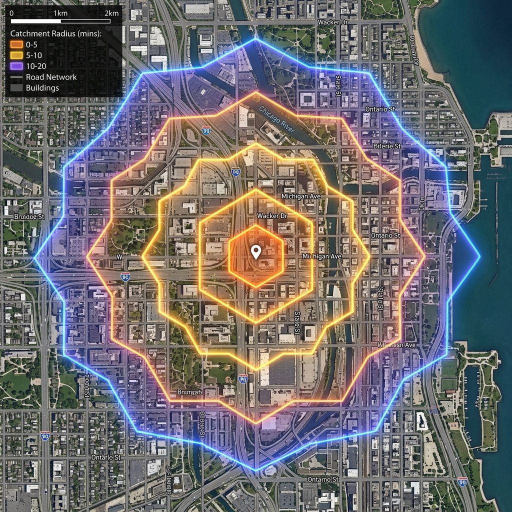 05 Oct 2025
 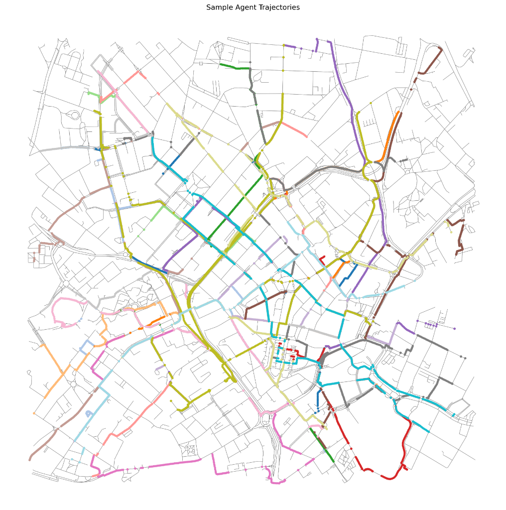 03 Oct 2025
 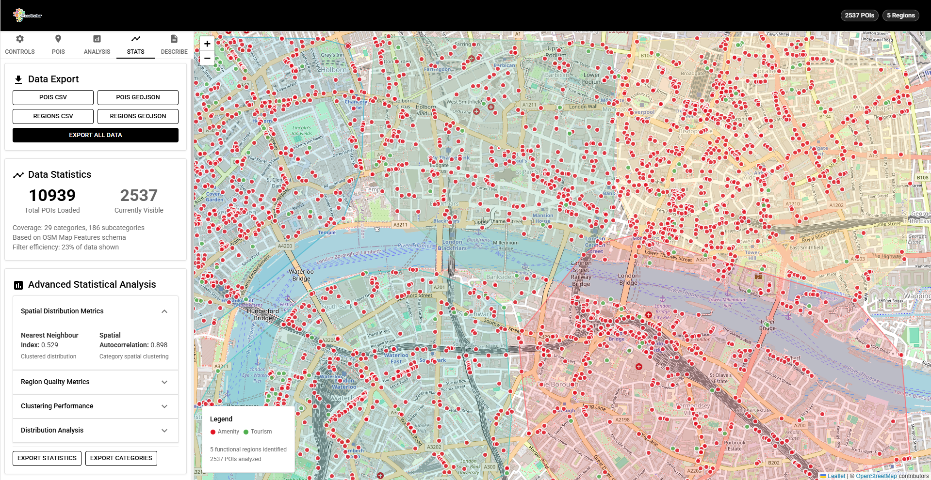 14 Sept 2025
H3 Catchment Analysis: Modelling Service Areas with Hexagonal Grids
Learn how to use H3's gridDisk, gridRing, and gridDistance functions to model service areas, accessibility zones, and multi-source catchment overlap. Includes interactive browser-based demos with step-by-step code.
05 Oct 2025 PlaceAgents: Modelling Multi-Stop Pedestrian Itineraries as Platial Flows
PlaceAgents is an open-source framework for simulating platial pedestrian flows in urban environments. Using OpenStreetMap data, H3 spatial indexing, and interpretable routing algorithms, it models how people chain together sequences of places for errands, work, and leisure.
03 Oct 2025 PlaceCrafter: Curating Urban Functional Regions through Platial Clustering
PlaceCrafter is a web-based platform that enables researchers to identify meaningful urban regions through clustering OpenStreetMap Points of Interest. Built with React, Leaflet, and D3.js, it provides interactive clustering, statistical validation, and platial visualisation of how cities are actually used.
14 Sept 2025 Diabetes Disparities in Mexico: A Spatio-Temporal and Marginalization Index Analysis
An overview of our W2GIS 2025 paper analysing diabetes-related hospitalisations and deaths in Mexico from 2005–2022, using the marginalization index to understand how social inequalities shape health outcomes.